


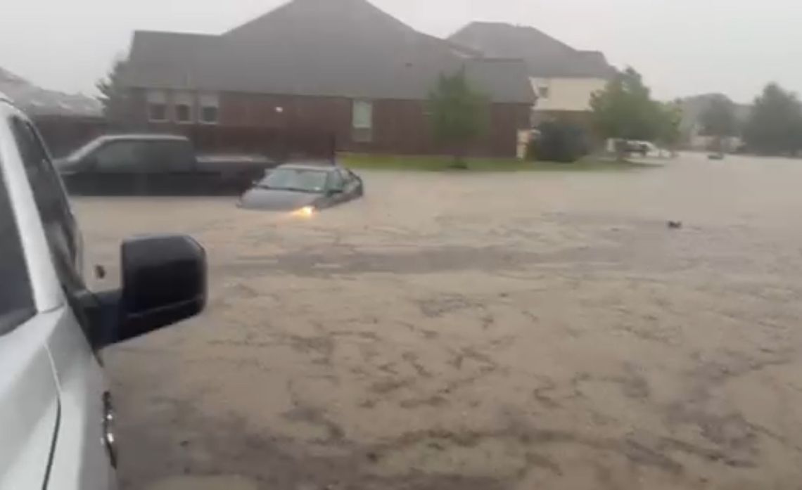
The National Weather Service has now issued a Flash Flood Emergency for Boerne until 8:15 p.m. Wednesday, July 15. This is the highest threat level.
Rescue Operations
As of 12:30 p.m., the City of Boerne has responded to 20 high water calls. First responders were able to assist people to shelter in place. Of those calls, the Boerne Fire Department assisted three rescues where they helped walk the people to safety and one boat rescue at Herff Road and River Road.
Disaster Declaration
The City of Boerne has issued a Disaster Declaration, signed by Mayor Frank Ritchie, due to severe weather and flooding. The City will be requesting additional resources from the state during and after this flooding event.
Trash Collection Changes
Boerne Utilities customers with service through WM can expect delays in their trash and recycling collections. Boerne Utilities will provide updates on collections timelines when available. Any missed collections will be addressed as soon as conditions permit.
Public Meetings Canceled
The City of Boerne Zoning Board of Adjustments and Appeals meeting scheduled for Wednesday, July 15 has been canceled.
---------------------------
11:37 a.m. WEDNESDAY UPDATE
The National Weather Service has issued a Flash Flood Warning for the area until 4:15 p.m. Wednesday, with more rain forecast throughout the day and the rest of the week.
The National Weather Service has informed us that heavy rain is expected over the next two to three hours.
Shelters in Boerne
Boerne ISD Central Offices: 235 Johns Road is open for anyone needing a safe place to seek shelter. Please enter off Lohmann Street, where staff will be there to assist.
------------------------------
10:20 a.m. WEDNESDAY UPDATE
Residents living along Cibolo Creek in the Heart of Boerne, Evergreen, Yolana, and West San Antonio Avenue areas should voluntarily evacuate now or prepare to shelter in place as water levels continue to rise.
Crews are closing River Road in all directions.
Conditions can change rapidly. Do not wait until roads become impassable.
Stay away from flooded areas, never drive through high water, and continue to monitor official City communication channels for updates.
----------------------
9:55 a.m. WEDNESDAY UPDATE
City crews are preparing to close Ranger Creek Road at the I-10 intersection as water levels continue to rise at Ranger Creek. Residents in the Lake Country and Shoreline Park neighborhoods are encouraged to voluntarily evacuate now while roads remain passable.
If you are unable or choose not to leave, prepare to shelter in place and be ready for changing conditions. Continue monitoring official City of Boerne emergency alerts for the latest updates.
Rain gauges west of the lake recorded more than 4 inches of rain Wednesday morning, adding to the more than 6 inches that fell Tuesday. The lake reached capacity on Tuesday, which will continue to rise as runoff flows into lake.
Lower water crossings continue to close in Boerne Wednesday morning, including Herff Road at River Road/Highway 46 and several others around town.
—————————
8:45 a.m. WEDNESDAY UPDATE
FLASH FLOOD WARNING: The National Weather Service has issued a Flash Flood Warning for the area until 1:15 p.m. Wednesday.
Heavy rain moved into the Boerne area overnight into Wednesday morning, dropping between 1 to 3 inches of rain with an additional 1 to 2 inches possible.
The City of Boerne has started to close low water crossings in town as the roadways become impassible. Please do not drive around barricades or into standing water.
These storms are also producing strong winds and have produced a potential tornado Wednesday morning at the Rim shopping center in San Antonio near the I-10 and Loop 1604 interchange. Keep your phone nearby and be on the lookout for emergency weather alerts.




Comment
Comments